SERVICES
Biophysical & Regulatory
Tannas Conservation Services is an award-winning Environmental consultancy. Our professionals have the experience and knowledge to navigate regulatory procedures and ensure each project meets all standards and receives all required approvals, whether it is during the project planning phase or site closure.
While our team can provide full service environmental coverage for our clients needs we are best known for our expertise in vegetation, wetlands, and soils across western Canada.
Protecting Land and Water in Western Canada
Regulatory assessments in Western Canada must address provincial and federal requirements, including the Water Act and the Alberta Wetland Policy, to ensure that land and water impacts are properly identified, classified, and approved before development proceeds.
At Tannas Conservation Services, we provide assessments on:
- Soils
- Land use
- Vegetation: biodiversity, rare species, plant community classification
- Wetlands: ABRET-A assessments, delineation and classification, restoration plans, construction management, regulatory permitting
- Wildlife: breeding birds & amphibians, habitat studies
- Aquatic: fisheries, habitat
- Associated reporting
- Regulatory Applications
- Expert witness support
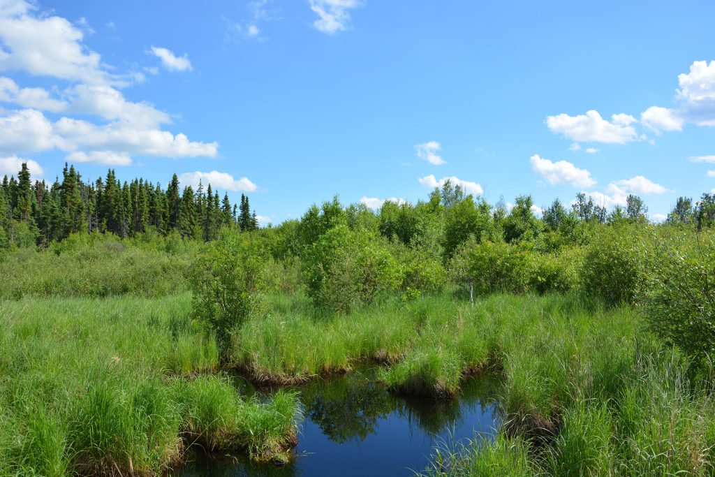
Experience: Our team of professionals has been working with wetland ecosystems for over 30 years. We have assessed wetlands for the purpose of compensation under the Alberta Wetland Policy as well as for land managers who want to improve the quality of their wetlands. We have worked with wetlands across western Canada in virtually every ecoregion.
Wetland Classification: We are experienced in classifying wetlands according to a number of proven wetland classification systems depending on your project needs. Our team employs a combination of soils, vegetation and imagery in order to classify wetlands. Some of the classification systems we specialize in include:
- Alberta Wetland Classification System
- Stewart and Kandtrud Classification System
- Canadian Wetland Classification System
Approach: It is our view that wetlands must be assessed in a careful manner as precipitation, management, and land use can affect the visual characteristics of a wetland as well as its underlying ability to function. We typically employ a combination of vegetation, soil, and hydrology indicators in the classification of each wetland to ensure a robust characterization of each wetland.
Permanence Mapping: To meet the regulatory requirements under the Alberta Wetland Policy we provide detailed permanency mapping that meets all regulatory requirements. We utilize a precipitation records to select appropriate images and classify each wetland based on indicators of permanency within the imagery. Our team has decades of experience in ecological land classification and can effectively identify vegetation indicators as well as indicators of hydrology to ensure we provide the most robust and reliable classification of permanency for each wetland.
Functional Assessments (ABWRET-A): We have assessed over 100 wetlands according to the Alberta Wetland Policy using the ABWRET-A assessment tool since 2015. In addition to this we have experience in other wetland assessment techniques depending on our client’s needs. We have extensive experience completing riparian health assessments as well as management plans and restoration plans for wetlands based on the results of functional assessments and health assessments.
Regulatory Submissions: We have extensive experience completing regulatory submissions for wetlands within Alberta and under the new Alberta Wetland Policy. We provide detailed reports with sound scientifically collected data to back up our reports.
Our team fields some of the best known vegetation ecologists in Western Canada. The Tannas name has been built on a specialization in vegetation. For the past 40 years our team has been completing vegetation assessments across Western Canada. Our leading plant taxonomists have published plant identification books (Common Plants of the Western Rangelands) and we teach up to 200 people plant identification annually.
Our expertise in vegetation spans across all forms of vegetation assessment and management including:
- Baseline Vegetation Inventories: Our team has completed numerous baseline vegetation inventories. These have included baseline biodiversity plots, nested transects, plant community mapping along with numerous other variations to our vegetation assessment protocols.
- Rare Plant Surveys: Our team has been conducting rare plant surveys for almost 40 years. Our experts can complete rare plant surveys in all western Canadian ecosystems and we provide highly trained and experienced plant taxonomists to ensure the highest quality of surveys. We are experienced in a number of different survey techniques allowing us to choose the appropriate survey protocol to meet our clients needs.
- Invasive Species Surveys: Our team has developed our own rapid survey methodology for invasive species surveys that have been implemented in National Parks, Conservation Areas, Municipalities and on First Nations across western Canada. We have developed protocols to allow rapid surveys that provide detailed data suitable for analysis and long term trend monitoring for invasive species management.
- Plant Community Mapping: Our team has multiple trained plant community ecologists and rangeland ecologists capable of mapping plant communities across Western Canada. Our mapping team has extensive field experience. Understanding the land being mapped is critical to the success of a mapping program as many plant communities can be very difficult to map.
- Research: Our team has an extensive portfolio of research programs that we have completed for our clients and internally to develop new reclamation and remediation technologies. We hold patents on floating island systems and native seed harvesting equipment related to our research work. Our team also has multiple Alberta Emerald Awards and has won and been a finalist in the ASTECH (Alberta Science and Technology Awards) for our research work. We provide research into rare species propagation and management, reclamation techniques for mines, phyto-remediation of selenium, along with numerous baseline ecological research programs.
- Native Plant Propagation: Our sister company Eastern Slopes Rangeland Seeds Ltd. is a major native plant material producer for western Canada. With 23,000 square feet of greenhouse space and additional outdoor growing capacity our native plant nursery is capable of growing hundreds of thousands of plants each year. We stock up to 300 species of native plants in seed bank and are capable of supporting our clients needs in plant material supply.
- Bioengineering Designs: Since the 2013 floods in Calgary our team has designed over 25 bioengineering projects with our partnering Engineering firms. Our experts are capable of designing appropriate bioengineering designs to meet almost any projects needs.
- Seed Mix Design: we have pioneered the science of seed mix design for reclamation and restoration projects with our long history propagating native plants. We have created a proprietary seed mix calculator that allows us to predict the plant community that will result form a seed mix and allows us to effectively create seed mixes that will create targeted native plant communities. Please see our publications section and courses for more information on seed mix design.
- Comprehensive Restoration Planning
The
Baseline Data Collection: Our team has extensive experience completing baseline data collection for all forms of projects regardless of their size and scope. We have been involved in baseline data collection for hundreds of projects over the past 30 years. Our team utilizes a mix of technology and proven scientific methods to provide the highest quality data collection for projects at a reasonable cost. We field a team of senior expert Biologists and Agrologists with proven experience.
Our team has experience in the following baseline assessments
- Vegetation: we complete comprehensive vegetation inventories including rare plant surveys, plant community mapping, baseline biodiversity plots, detailed transects, invasive species surveys
- Land Use: we have extensive experience in land use mapping and assessments.
- Soils: Our team employes multiple soils and reclamation professionals along with our partners to provide full-service soil surveys to meet our clients needs.
- Wildlife: Our team includes wildlife experts that conduct breeding bird and amphibian surveys, habitat assessments, wildlife camera and audio monitoring programs, along with large ungulate management planning and assessments.
- Fisheries: Our team can provide support for all fisheries and aquatic related assessments for our clients
Reporting: Our team has completed numerous baseline reports for BIA’s and EIA’s across western Canada. Our projects have varied from small municipal projects to major Provincial and National projects. We have provided regulatory reports for the AER (Alberta Energy Regulator), AUC (Alberta Utilities Commission), Municipalities (Cities, Counties, Towns), and other Provincial and Federal entities across western Canada.
Environmental Impact Assessments: Our team has been involved in numerous small EIA’s for federal projects along a number of large complex EIA’s where we have partnered with other consultants to complete the EIA’s. We focus on high quality data and providing our clients with innovative solutions to allow EIA’s to be successfully approved. We are happy to partner with other firms to provide comprehensive services and the highest quality end products for our clients.
Biophysical Impact Assessments: Our team has extensive experience completing BIA’s at the municipal level across Alberta. Our team is experienced in helping our clients navigate the complexities of municipal approval processes and we can provide comprehensive field assessments, analysis, reporting and regulatory support to meet any projects needs at a municipal level.
Regulatory Support: Our team has provided our clients with comprehensive regulatory support regardless of the type of project. we have submitted applications for DFO, Transport Canada, Public Lands Act, Water Act, Historical Resources, Municipal BIA’s, AER (Alberta Energy Regulator) Mine Construction & Reclamation Plans, AUC (Alberta Utilities Commission) Agricultural Impact Assessments, Irrigation Assessments, Environmental Protection Plans, Construction and Reclamation Plans, Vegetation Management Plans, Clubroot Management Plans.
Baseline Assessments
Environmental Impact Assessments (EIA): Soils, land use, vegetation, aquatics, wetlands, archaeological, wildlife, species at risk, and associated reporting.
Pre-Disturbance Site Assessments (PDSA): Soils, land use, vegetation, aquatics, wetlands, archaeological, wildlife, species at risk, and associated reporting.
Biophysical Impact Assessments (BIA): Soils, land use, vegetation, aquatics, wetlands, archaeological, wildlife, species at risk, and comprehensive reporting.
Wetland Assessments: Full wetland assessment and impact report(s), including wetland delineation, classification, mapping, and regulatory applications.
Experience
View ProjectsTannas Conservation Services has surveyed over 2 million hectares across Western Canada, from the Arctic Ocean to the U.S. border. Our experienced team integrates field and office work, ensuring the specialist writing the report is the same person who was on the ground
- Completed dozens of field assessments for BIA’s EIA’s, PDSA’s across western Canada.
- Completed Major EIA Discipline reports, and completed EIA’s along with partnering with other firms to complete them on large complex projects.
- Completed over 500 wetland assessments using the 2015 Alberta Wetland Policy, and hundreds of wetlands have been assessed under previous wetland assessment guidelines.
- Completed dozens of DFO and Water Act approvals for wetland and bank stabilization projects.
WORK WITH
an Environmental Impact Assessment Consultant Today
Tannas Conservation Services provides regulatory assessments that support responsible development while meeting all requirements under the applicable legislation. With offices in Cranbrook, Kimberley, Cremona, Edmonton, Pincher Creek, and Calgary, we’re positioned to assist projects all across western Canada. Connect with our team today to discuss your needs.